I recently went to Turtleback Arch at Red River Gorge in Pine Ridge, KY.
This trail is a moderately challenging one because of some rock scrambling you have to do towards the end. However it more than makes up for it with multiple interesting and historical stops along the way to a very unique arch!
Plan to be out for at least 3-4 hours depending on your skill level

The best way to do this trail is to start at the Rock Bridge trailhead on Rock Bridge Road. From there, we’ll connect to some other trails to create a giant loop to Turtleback Arch.
After you start, you’ll quickly go past Creation Falls (seen above), which is a popular destination for skinny-dippers and casual swimmers at the gorge- especially in the summer.
You’ll continue for a few hundred yards until you reach Rock Bridge, which is a unique geologic feature in this area!
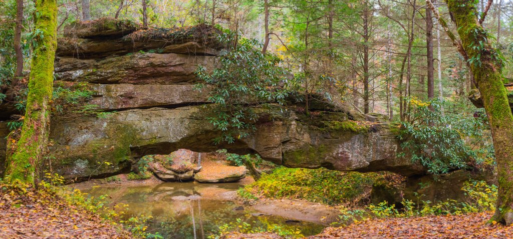
Unlike most arches at the Gorge, Rock Bridge is a natural bridge. Geologically speaking this means that it was formed by a body of water cutting through the stone to make a bridge shape. If it was an arch, it would have been formed from other erosive processes!
Rock Bridge is unique in the gorge for this reason, since it is one of the few natural bridges in the area. Nearly all of the arch formations at the gorge are geologically arches.
You can actually climb on the bridge and get some good views of Swift Camp Creek – especially in the fall.
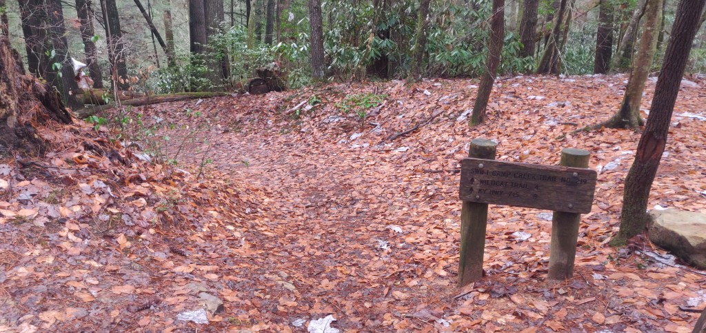
Continue on the trail past the intersection of the Rock Bridge and Swift Camp Creek Trails and stay on it for about 2 miles.
You’ll pass some user-defined trails to see historic artifacts like a prohibition-era moonshine still! If you want to find directions to that, look up Bearpen Branch Still.
You’ll know you’re getting close to the trailhead for Turtleback Arch when you hear a waterfall nearby the trail.
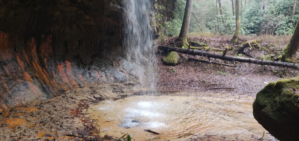
These falls are really pretty to see- especially in the winter when they can freeze over and create ice falls. They’re named Pooch-Turtle falls because the of the source for the water (Dog Branch) and their proximity to Turtleback Arch.
You can go down to the falls if you like and appreciate them from below. Just be careful because there is a bit of a rock scramble required to get down to them. Bring a rope if you think you’ll need it!
The Swift Camp Creek trail continues over Dog Branch, but you’ll actually be wanting to follow a user trail that goes up the ridge just after the creek crossing. It’s very distinctive after many years of foot traffic.
Follow that trail to a clearing that has a nice secluded campsite. This would be a good spot to camp even if you were not going to see the arch!
The rest of the trail is spent following the ridge and trying to get as high up as possible. This is where the major scrambling starts. As long as you can get some good foot and hand-holds this section should be a breeze.
From there try to follow the more heavily trafficked path as best you can- remembering that the primary goal is to go up.
Eventually you’ll be confronted with a trail that deviates from the main path and veers down and to the left a few dozen feet. Take that and follow it until you reach the main attraction- Turtleback Arch!
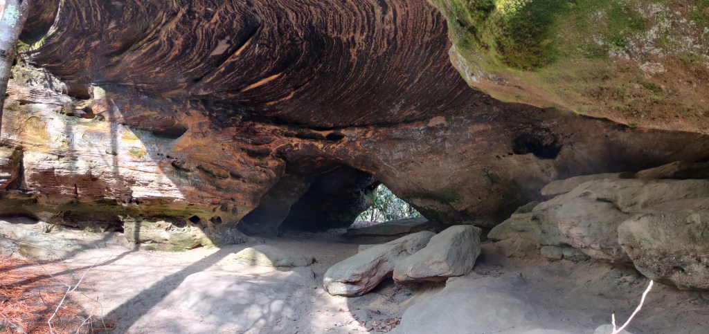
This is a very unique-looking arch at the Gorge. The strata along the top are the result of iron deposits in this area from hundreds of millions of years ago. In fact the whole Gorge area is rich in these iron deposits, which cause features like Pooch-Turtle Falls and Turtleback Arch among others to have this reddish quality to them. It’s also likely the reason that the Red River is called the Red River!
Going through the arch, pay attention to the baby Turtleback Arch on your right. It’s good luck to go through it!
Continue in the direction of the baby arch and hug the wall as you start your ascent to the top of the arch. Your goal now is to head west to get back to Rock Bridge Road.
You will reach your next rock scramble in several hundred yards. This one is one you should be careful with. There is a tree that you can use to help get up this one, and you can tell how many people have used it based on how smooth the bark is in certain sections.
Once you’ve finished the final rock scramble, you can follow the user trails until you reach a junction about 1.5 miles in to the ridge. Take a left and continue in that direction until you reach Rock Bridge Road. From there turn left and head back to the parking lot!
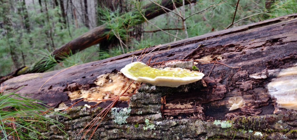
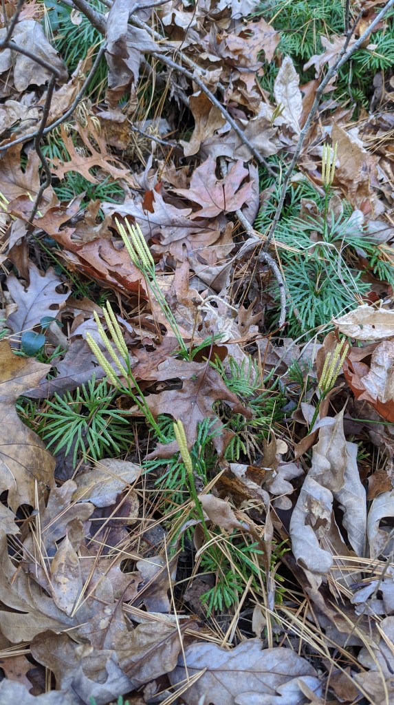
Make sure you pay attention to some of the flora you see along your hike. The time of year can greatly impact what you see, although it is certainly guaranteed to be interesting. Here are some of the plants and fungi I’ve found doing this hike!


Leave a comment