In September I took a long weekend to head down to Crater Lake National Park in Oregon. If you haven’t heard, this was the last season that the trail down to the lake will be open until 2029. The rest of the park will remain open, but the trail which leads to Crater Lake will be closed for restoration until then so I decided to book a spot on one of the last boat tours before the closure since I had never been in the area before!
This trip was a lot of driving that took me over the Cascades, into Crater Lake NP, into the redwoods, and along the Oregon Coast.
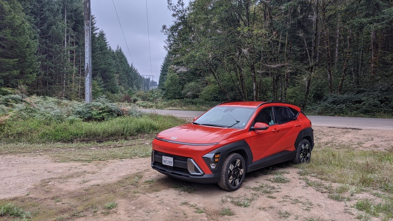
Sadly my Jeep did not join me for this trip because it was in the shop at the time getting some rust damage repaired! So I got a rental car that ended up being pretty nice. And you know what they say… the fastest car in the world is a rental!
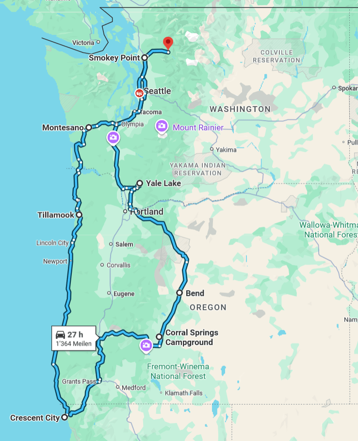
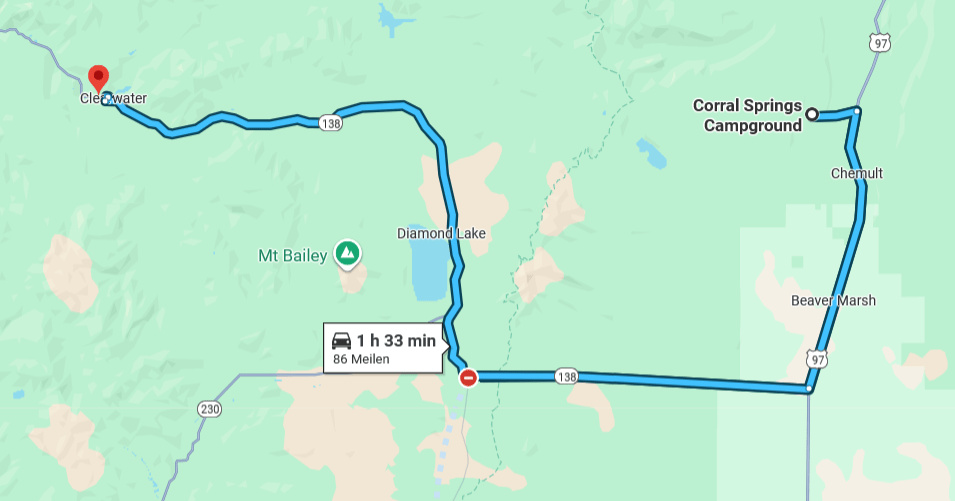
Here’s the route I took over the course of 5 total days of driving. I picked up my rental car from Smokey Point, which is near Darrington. It was a 2025 Hyundai Kona, which ended up being a really good car for this trip. I ended up sleeping in the back just like the XJ, but it wasn’t quite the same. My main complaint is that the back seats don’t fold all the way flat – so when I sleep in the back, there’s a bit of elevation gain around my hips! Otherwise it worked out nicely – just without the extra storage space the XJ gives me.

- Day 1: Smokey Point -> Yale Lake
- Day 2: Yale Lake -> Corral Springs, OR
- Day 3: Crater Lake!
- Day 4: Toketee Falls -> Redwoods -> Siuslaw NF
- Day 5: Siuslaw NF -> Tillamook, OR -> Darrington, WA
Day 1: Smokey Point -> Yale Lake

My first half day of driving was not that eventful. I actually worked for half the day that day and picked up my rental car in the afternoon, braving I-5 traffic to get to a dispersed camping spot on the Gifford Pinchot National Forest. Eventually I got there just before sunset and had a pretty peaceful night of sleep testing out this new improvised setup for the first time.
Day 2: Yale Lake -> Corral Springs, OR
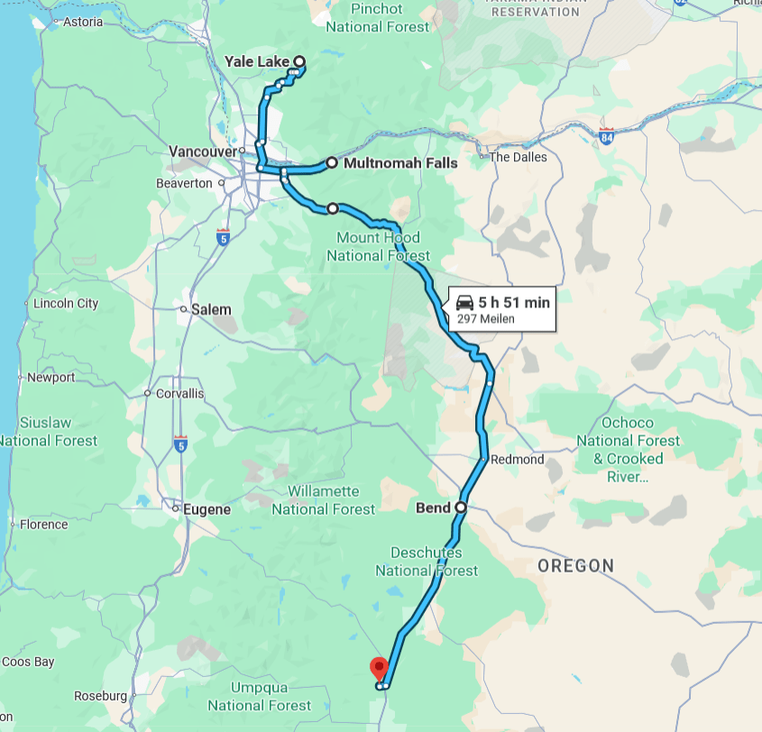
The second day of my trip had a lot more going on!
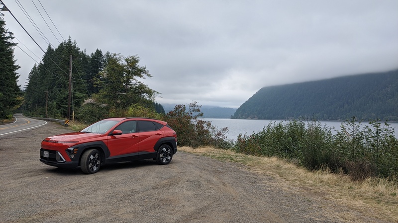
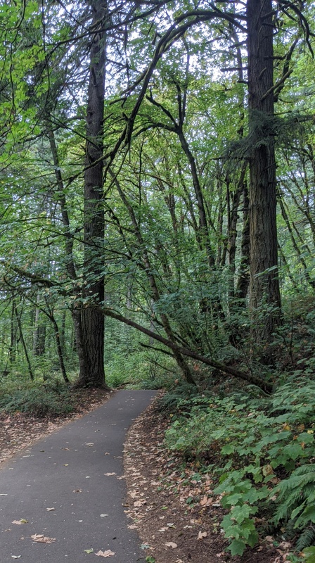
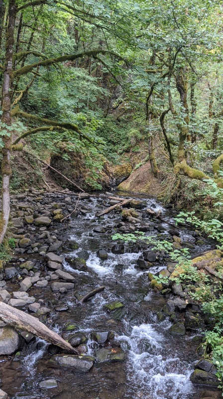
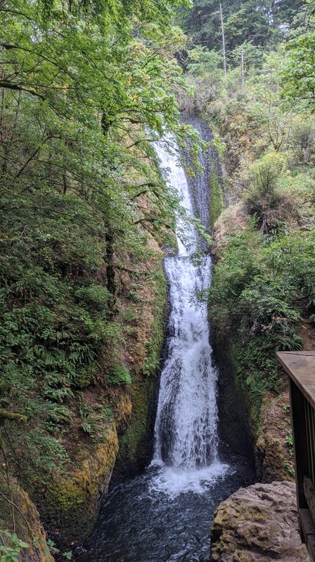
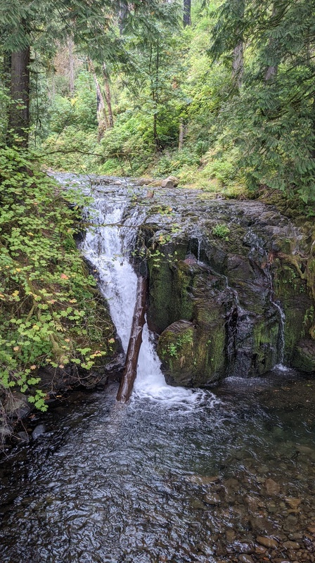
I survived the night at Yale Lake and had breakfast at the beach there. Then I drove to some of the famous waterfalls in the Columbia River Gorge. I went to two: Bridal Veil Falls, and Multnomah Falls.
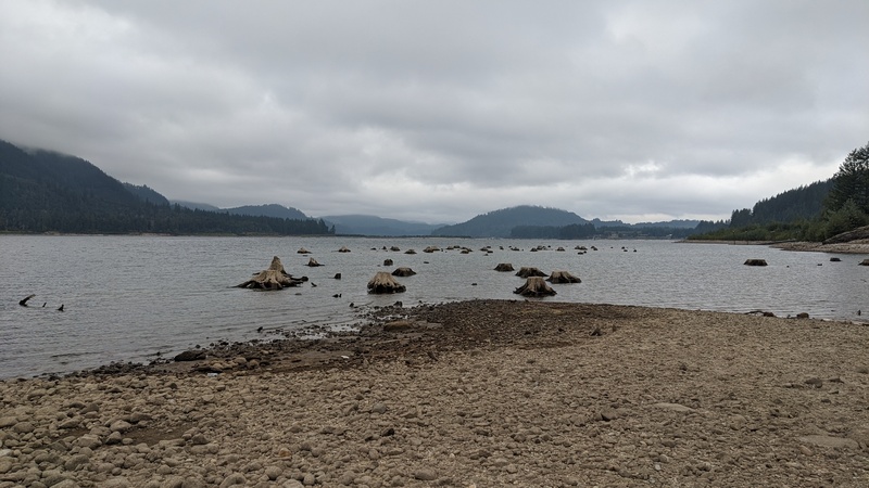
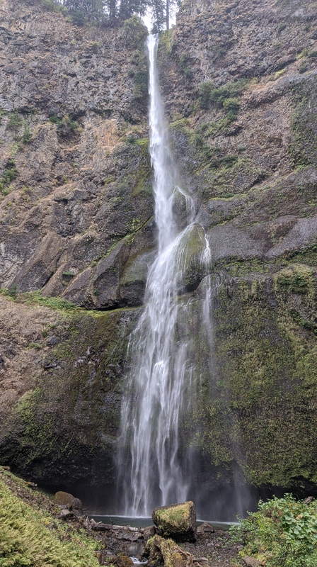
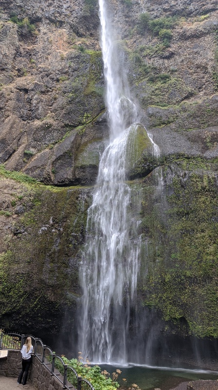
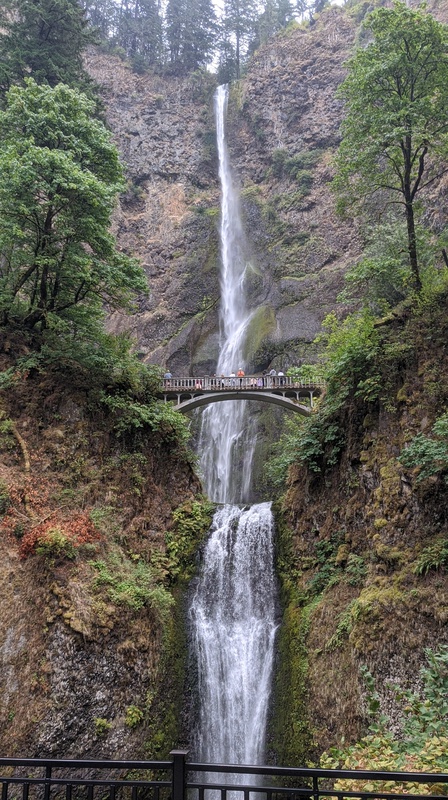
Multnomah Falls is one of the most popular waterfalls in the entire state of Oregon. I’ve seen it on so many post cards, and seeing it in person was pretty cool!
It has a pretty iconic bridge that you can walk on and take pictures from. If you keep going, you can also hike up to the top of the falls and access a cool trail network at the top of the Oregon side of the gorge.
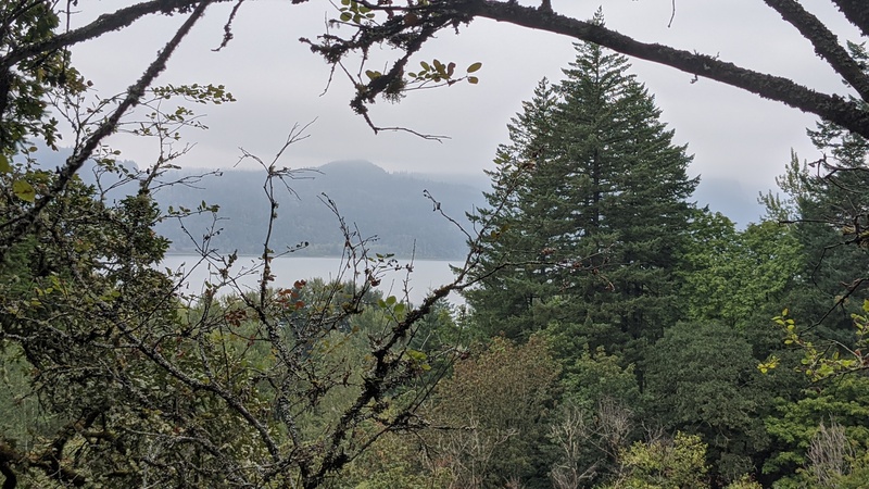
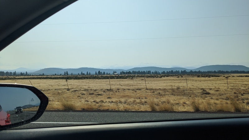
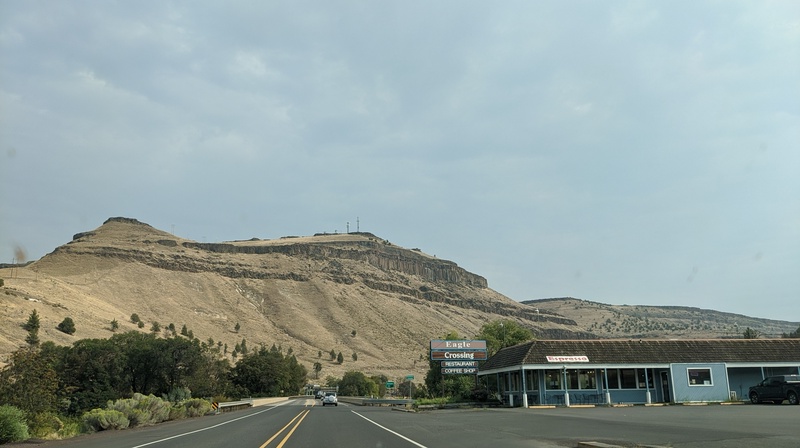
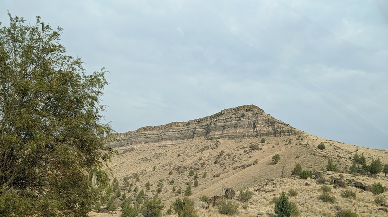
After the falls, I started to head to where I had planned to camp – just outside of Crater Lake. On the west side of the cascades, the weather was typical Pacific Northwest: cloudy and rainy. I drove past Mt. Hood on my way to Bend, OR, but sadly wasn’t able to see it because of the fog. A trip for another time though!
Once I crossed over the pass to the east side, the weather changed completely and was sunny and dry!
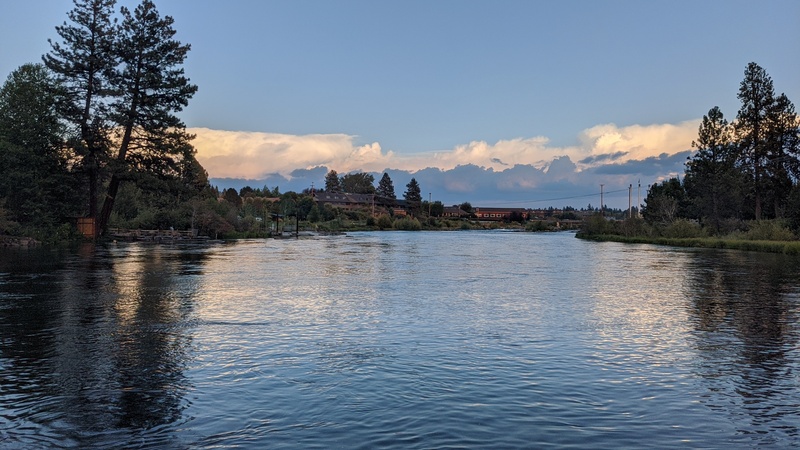
I didn’t take too many photos of my time in Bend, OR – just the one you see above of the river running through town. I stopped for dinner and sat by the river eating what I got. To my surprise, I ran into a friend from college who was working in town! We caught up and hung out for a bit, then I said my goodbyes and we parted ways.
As the sun was setting, I drove across the high lava plains of central Oregon and found a spot in a fee-free campground for the night. I was the only one there and it was super peaceful! The temperature ended up getting close to freezing overnight, but I was warm in my car.
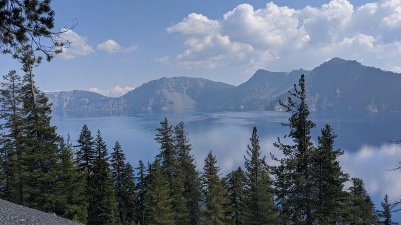
Day 3: Crater Lake!
This was the big day! My tour of Crater Lake was in the afternoon on boat, but I got up early to check out the park before the tour.
I had timed it just right because as I was arriving, there was a group of bikers getting ready for the Ride the Rim.
According to the NPS:
““Ride the Rim continues to grow in popularity every year,” said acting superintendent Elexis Fredy. “It provides a unique opportunity to experience East Rim Drive without vehicle traffic. While it’s a strenuous endeavor, the rewards of a slower pace, opportunities for quiet reflection, and healthy, vigorous recreation make it a special experience for many people.””
It was cool to see so many bikers getting ready!
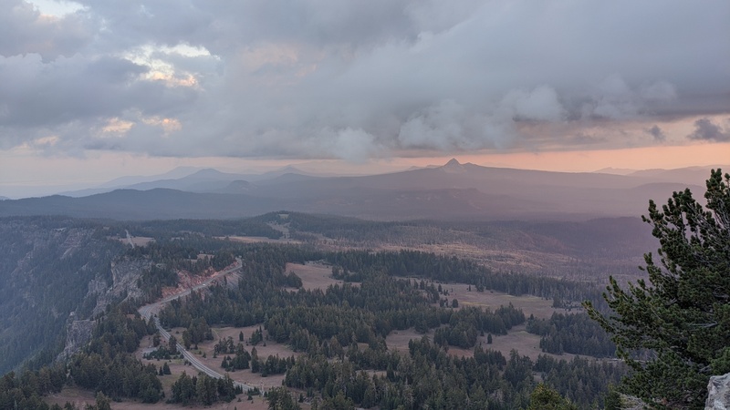
I drove around the east rim and west rim of the park before eventually stopping for lunch at the Cleetman Cove trail, where my tour would be starting from.
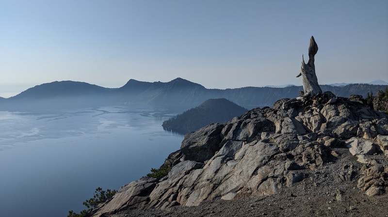
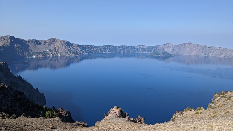
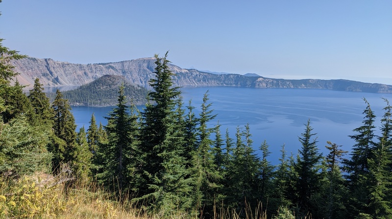
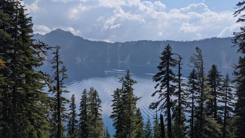
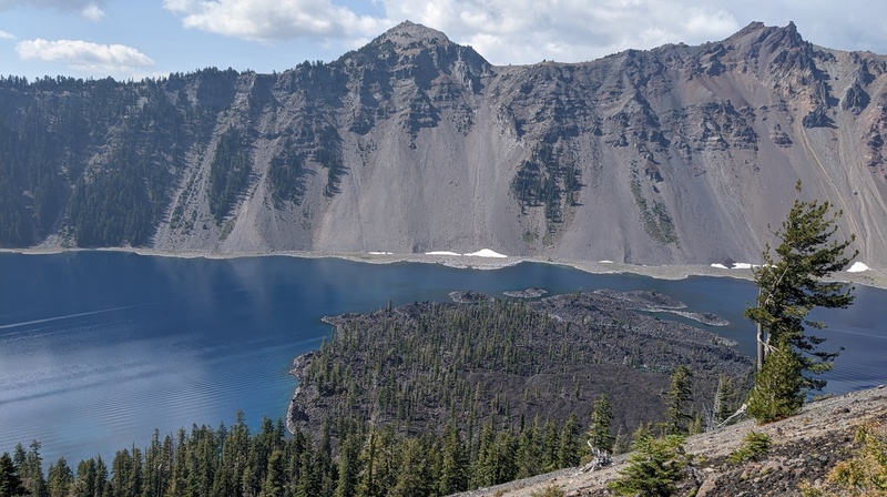
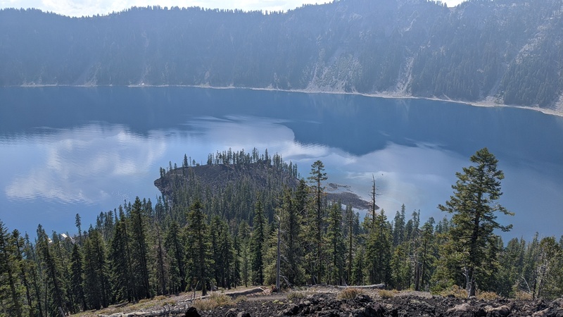
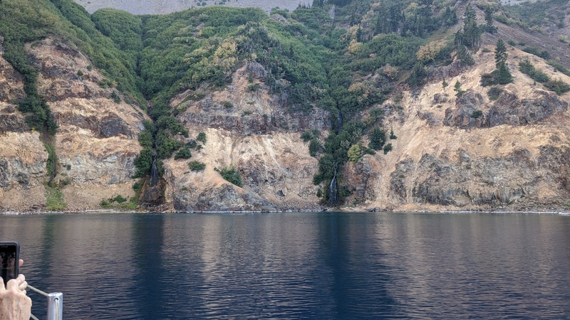
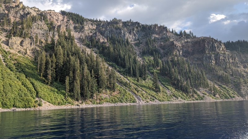
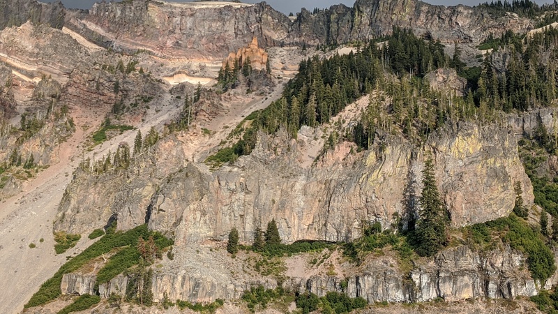
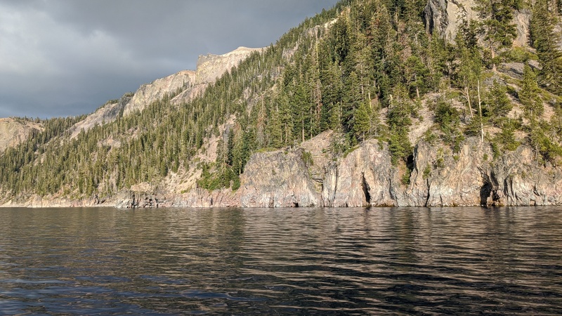
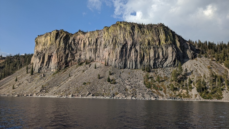
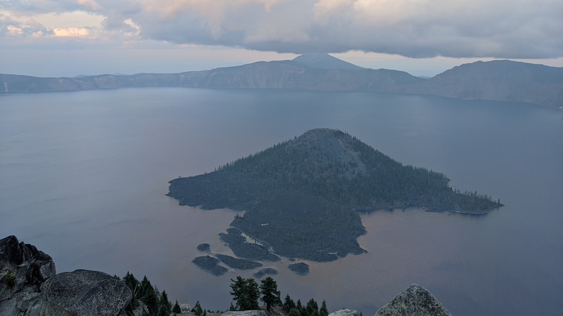
My initial impression of Crater Lake is that it’s absolutely huge! Way bigger than the photos would make you believe. It’s about 5 mile across and was formed after the eruption of ancient Mount Mazama 7,700 years ago.
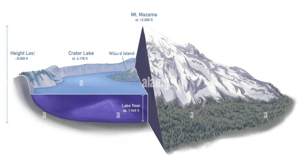
The park, as it exists now, lives in the footprint of what once was Mt. Mazama. All of the water that is in Crater Lake comes from snow and rain, with very little runoff – making the lake one of the purest sources of water in the world. So pure, in fact, that we stopped the boat tour in the middle of the lake and filled up our water bottles using lake water!
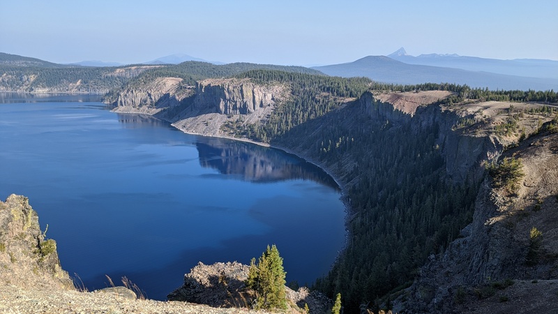
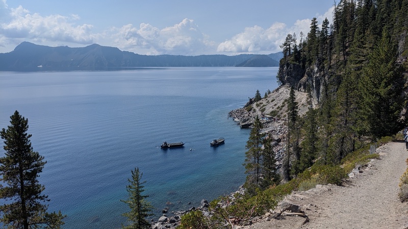
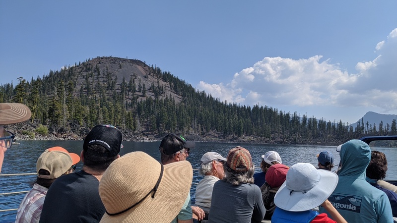
The tour was super informative and unique. We went to Wizard Island (the island in the middle of Crater Lake) and got to spend a few hours there hiking and relaxing mid-tour.
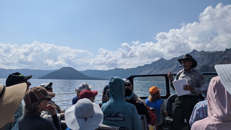
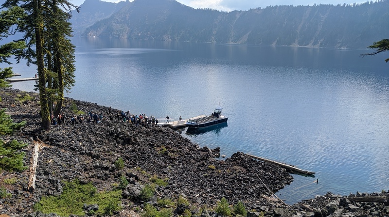
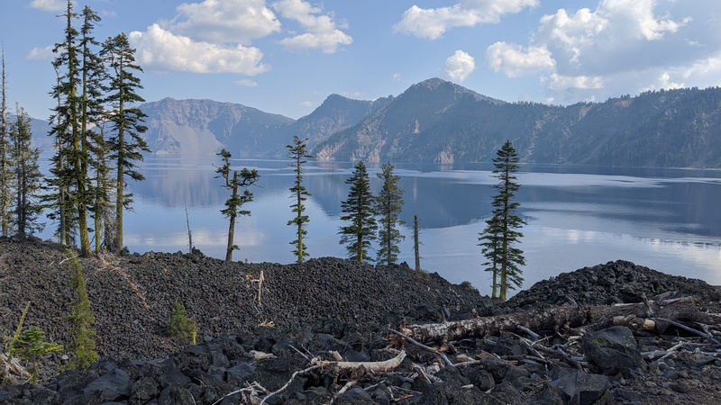
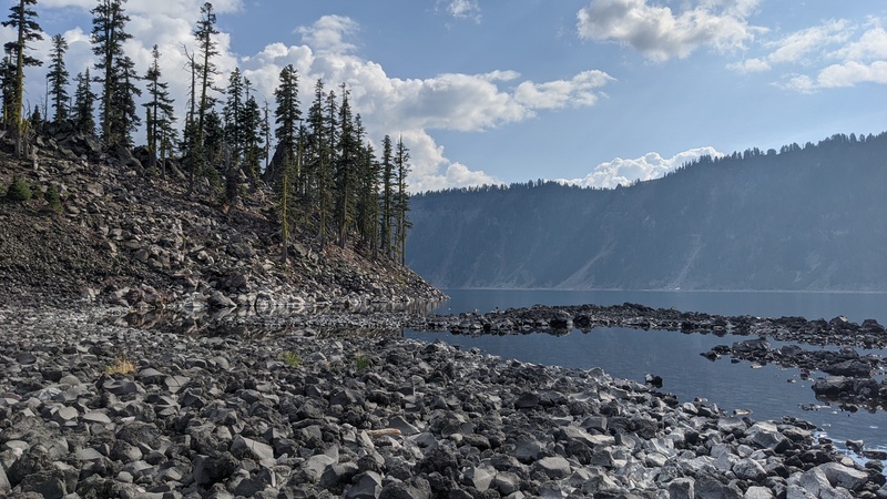
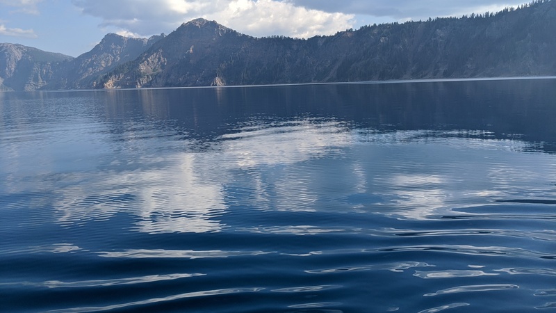
We got a complete geologic history and stopped at some cool sites in the lake that are only visible from the water.

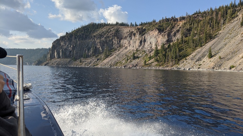
The tour in total was about 5 hours and was absolutely worth it! I’m so glad I went, and it’s something that you, dear reader, should put on your bucket list for when the trail to the lake opens up again in 2029.
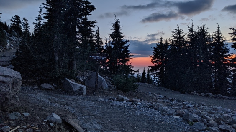
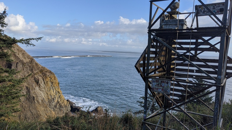
After the tour, I climbed to the top of the rim and hiked to a fire lookout tower just in time for sunset!
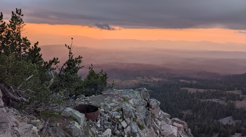
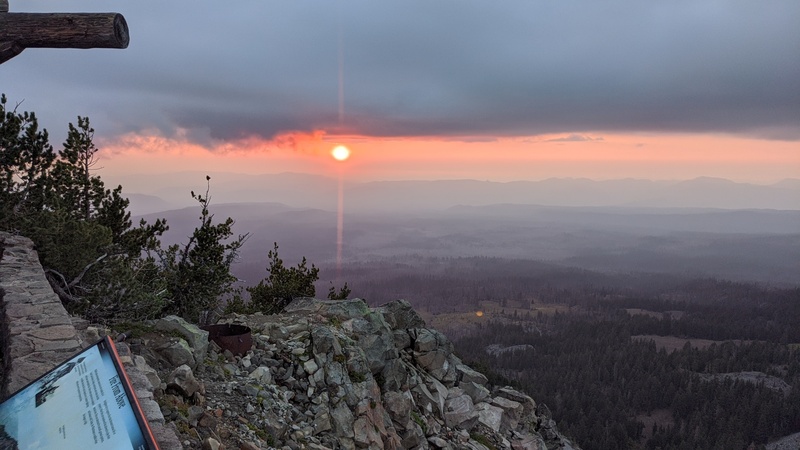
There was a cool group of people up there that were fun to chat with and I got convinced to make an extra stop in my trip to see the California redwoods just south of the Oregon border.
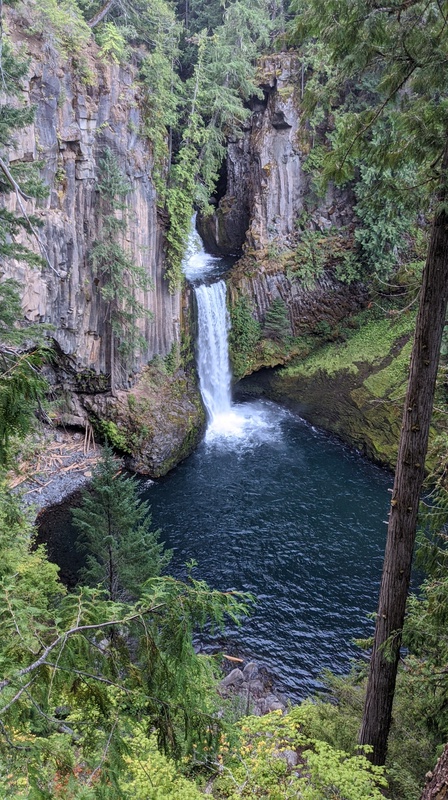
When the sun was totally set, I headed back to my car and camped for the night near Toketee Falls, which a friend recommended to me, and slept really really well.
Day 4: Toketee Falls -> Redwoods -> Siuslaw NF
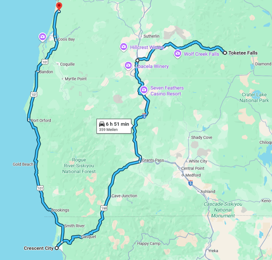
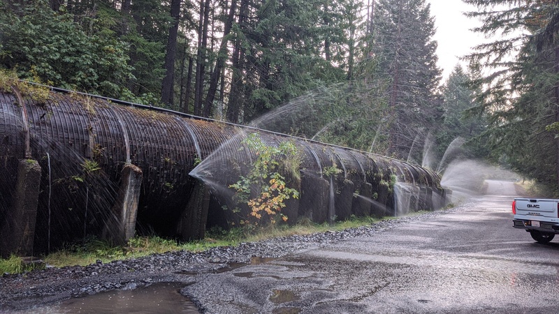
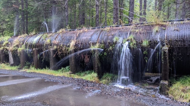
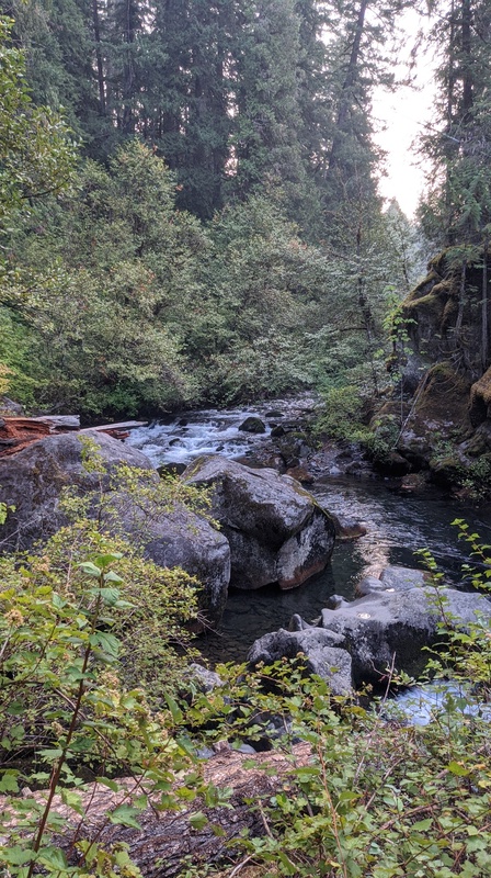
The first thing I had to do this morning was to check out Toketee Falls, which is a really beautiful waterfall that flows through basalt columns on the west side of the cascades. It was a short hike from the parking lot, which was being inundated with water from the redwood pipes that were helping discharge the nearby dam.
After the short hike, I hit the road to check out the redwoods in Northern California.
If you’ve never been to the redwoods before, it’s can be kind of confusing since there is not a singular Redwood National Park. Well, there is technically a Redwood National Park, but it’s part of a complex of multiple state parks which make up the Redwood National and State Parks system. So if you type in “redwood park” into your GPS, it’s not going to know where to send you!
Entering California was interesting since it was my first time driving into the state. They had an agricultural inspection checkpoint that was almost like a border check. I had to tell them if I had any cherries, apples, or other fruit to prevent the spread of invasive pests.
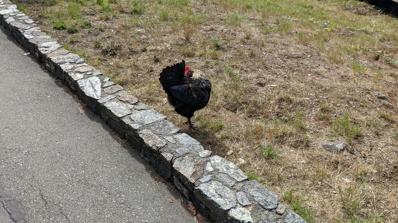
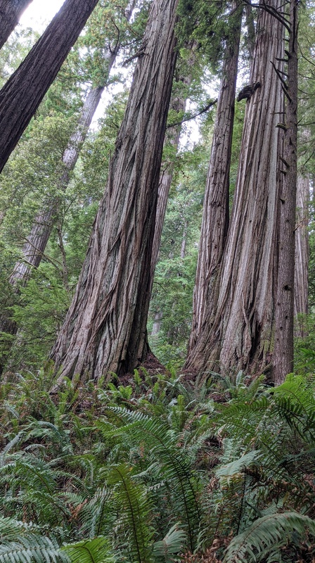
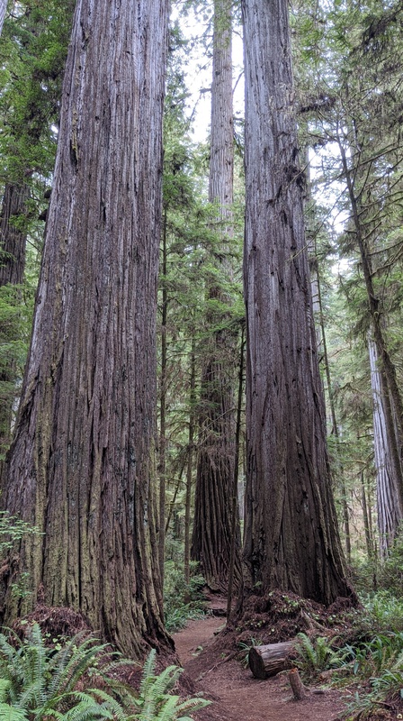
Eventually, though, I got to the closest redwood park to Oregon, Jedediah Smith Redwoods State Park.
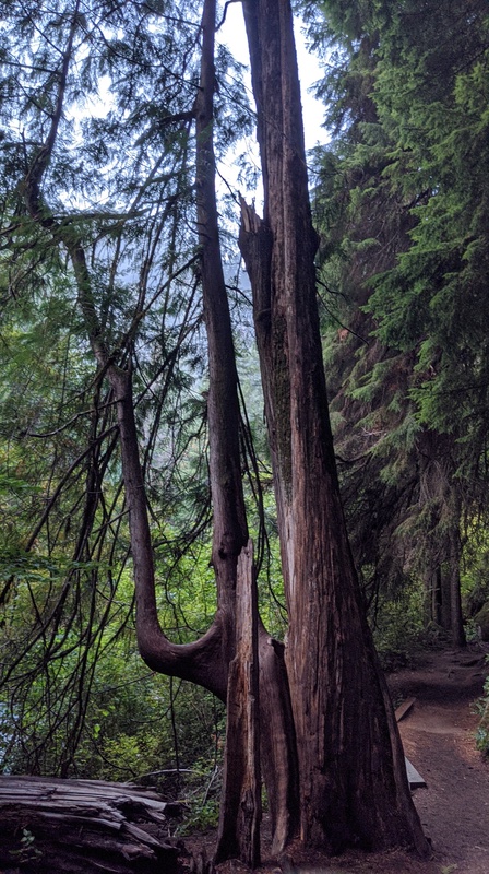
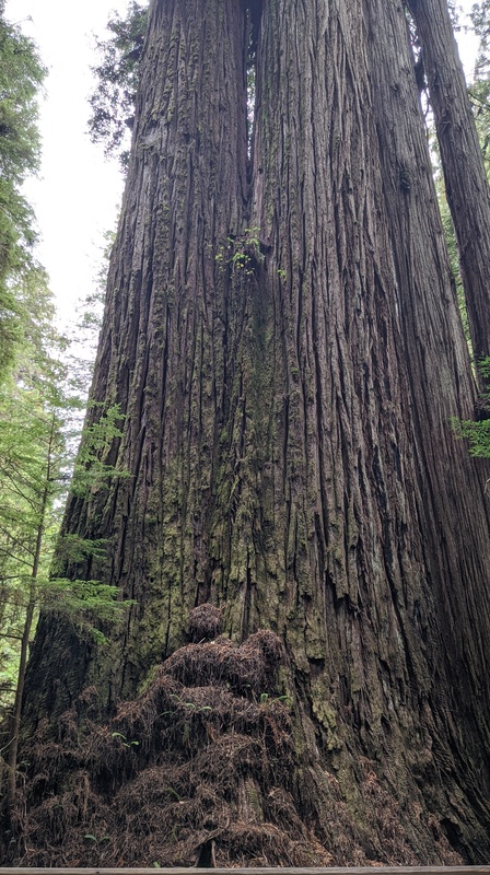
There, they have groves of old-growth redwood trees that are absolutely amazing to see in person. First, though, I stopped at the visitor center and said hi to their chicken!
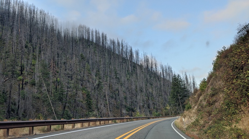
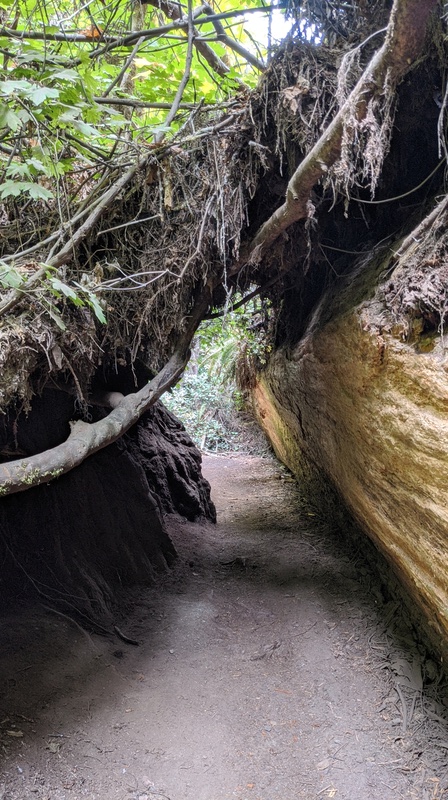
The redwoods themselves are a ways away from the visitor center, past a gravel road that goes through an old burn scar. Once you get there, though, it’s totally magical.
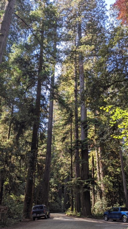
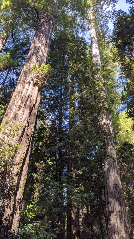
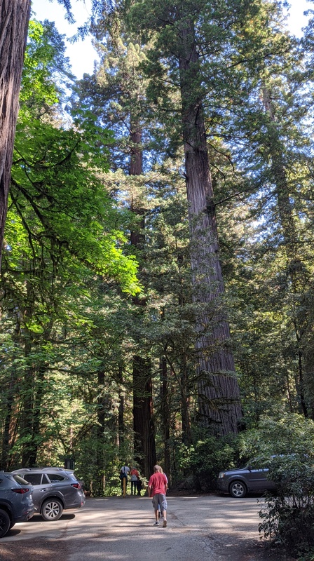
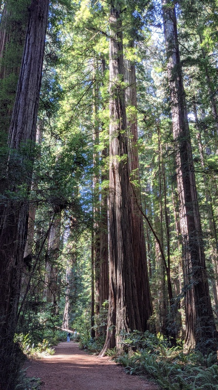
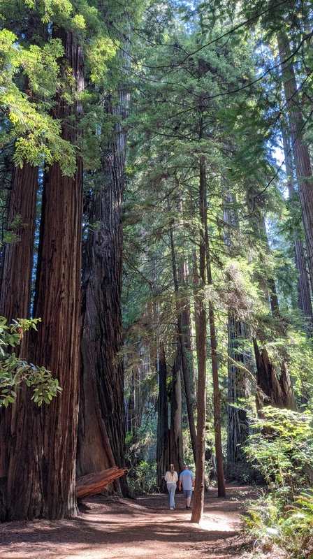
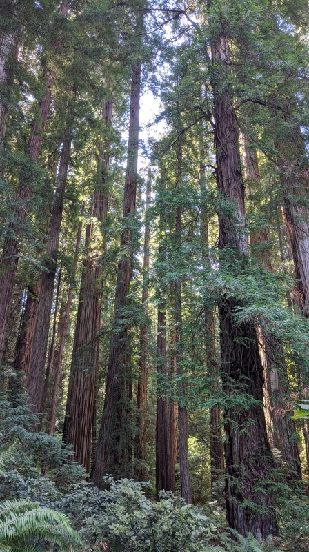
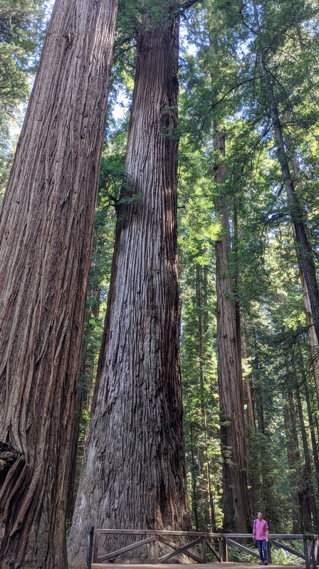
I’m used to seeing some fairly large trees in Washington, but believe me when I say – these trees were HUGE. It felt otherworldly being among them and this was one of the few parks I’ve been to where all of the visitors seemed to be amazed and in agreement of how (biblically) awesome these trees are.
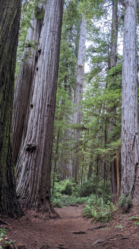
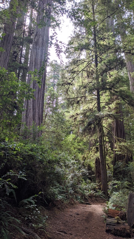
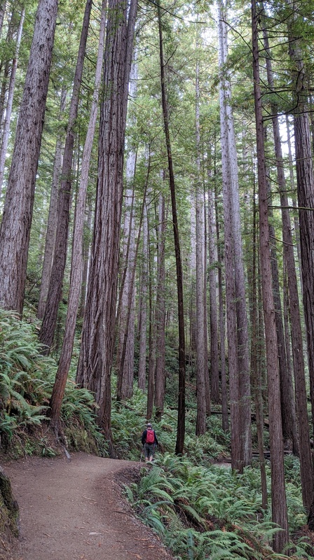
I hiked along many of the short trails they had alongside the road to take in the beauty of these trees, then headed out when it was time to get going north to Oregon. Eventually, I’d like to come back to see more of the parks in this complex and to see more redwoods!
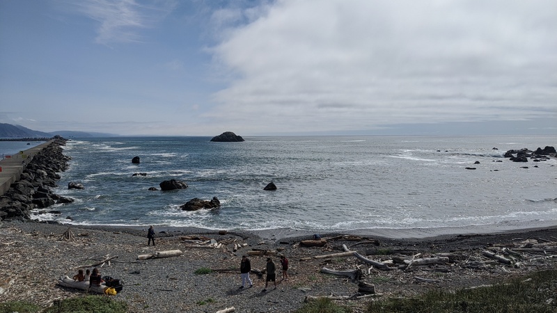
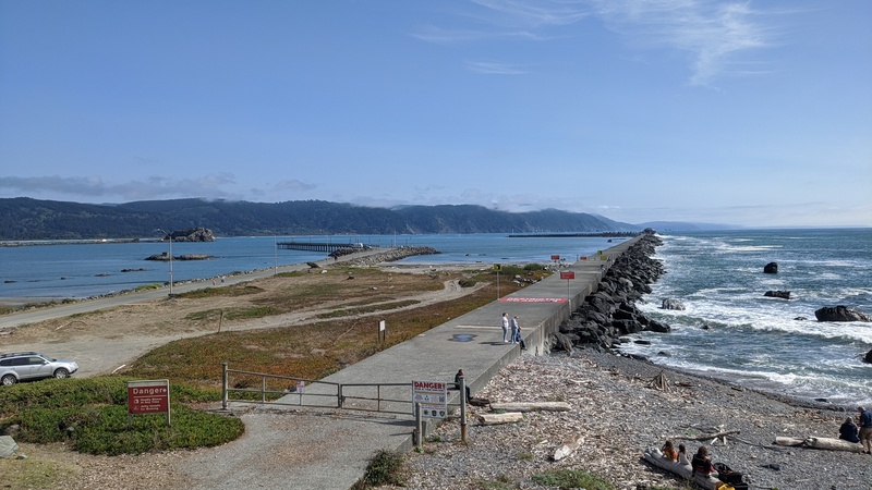
If you take the road where all of the trails are all the way to the end, you get spit out right by the ocean in Crescent City, CA. I took some time to drive to the beach and walk around before I joined up with US Highway 101 north up to Oregon.
I wish I could have stayed longer in California, but I had to get going north so I could get to Darrington at a reasonable hour the next day. So I said my goodbyes and hit scenic route 101.
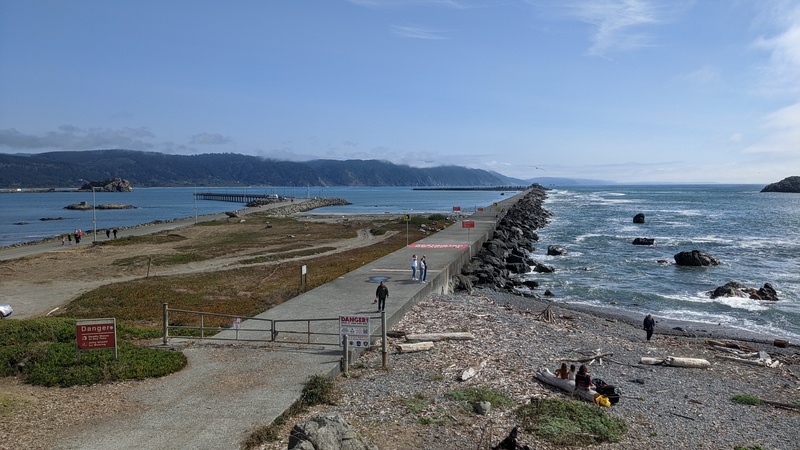
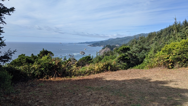
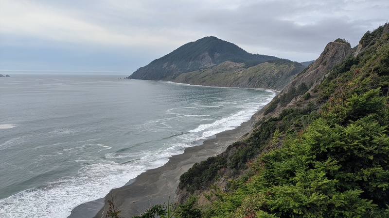
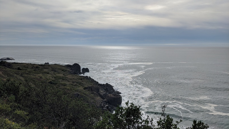
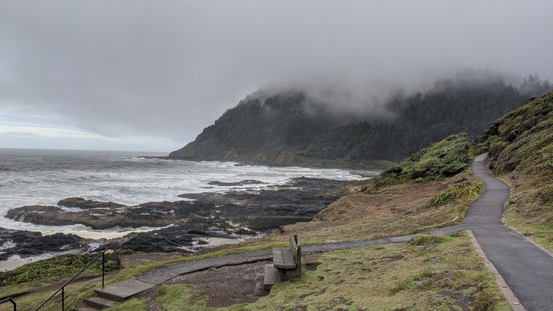
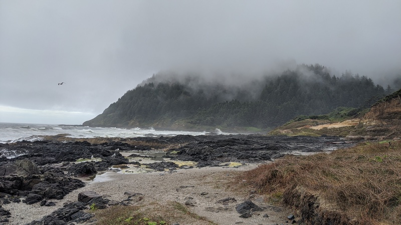
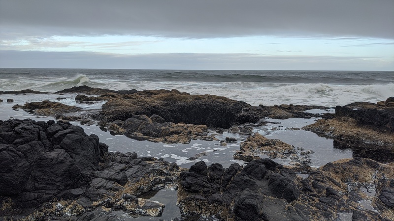
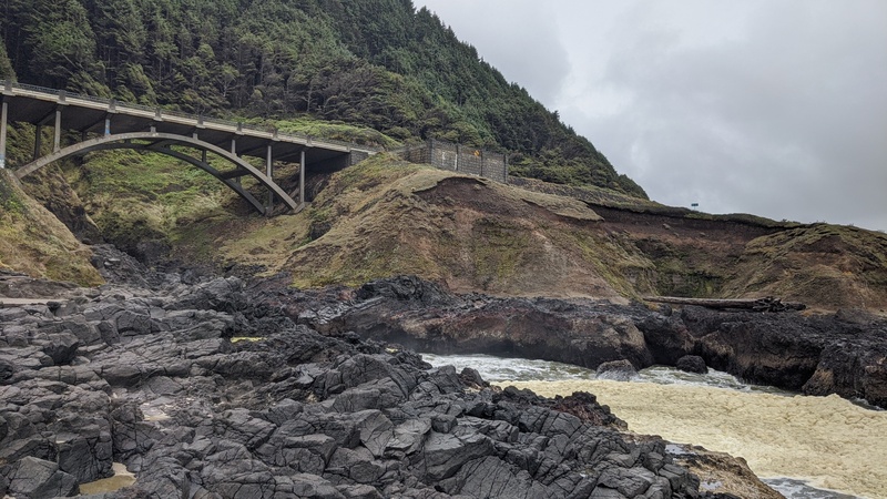
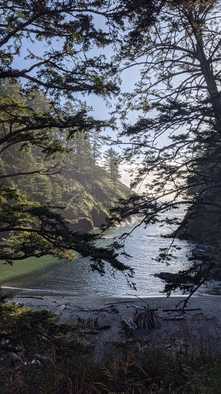
The thing about the Oregon Coast Highway (rt. 101) is that in the section that passes through Oregon, it’s basically entirely on the coast, which makes for one of the most scenic drives in the country. There are plenty of turnoffs, state parks, restaurants, beaches, and whatever else you need to be happy on your 101 trip along the roadside.
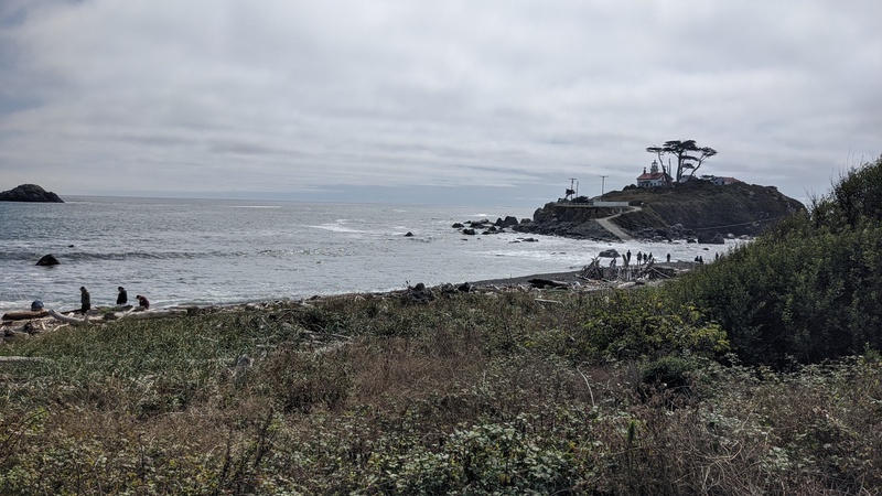
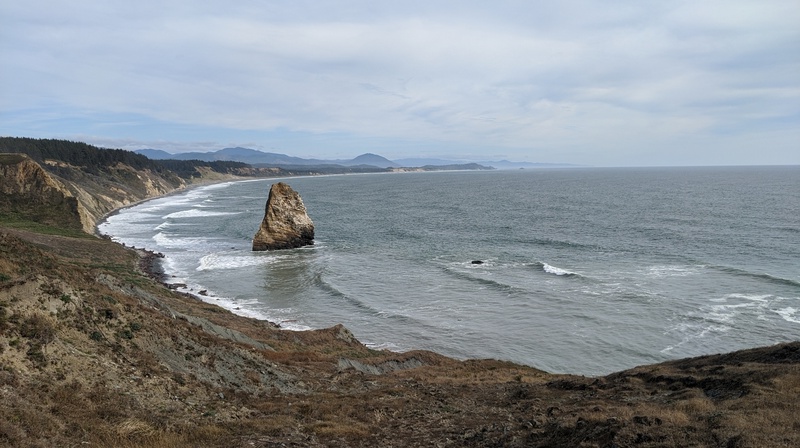
I spent the rest of the day driving until I found a spot to camp for the night, and stopped at a few sites – notably an historic lighthouse, and devils kitchen (one of many devil-themed stops along route 101).
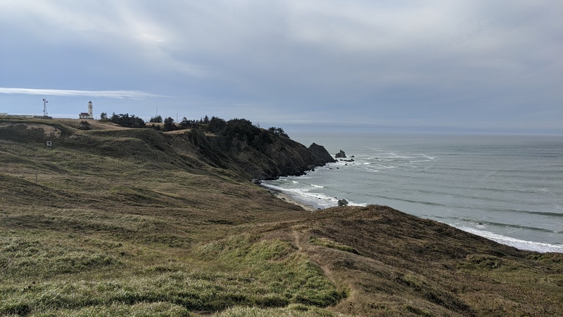
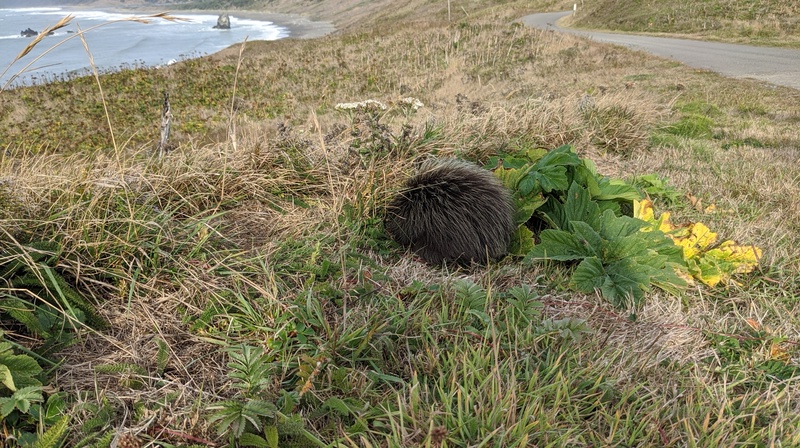
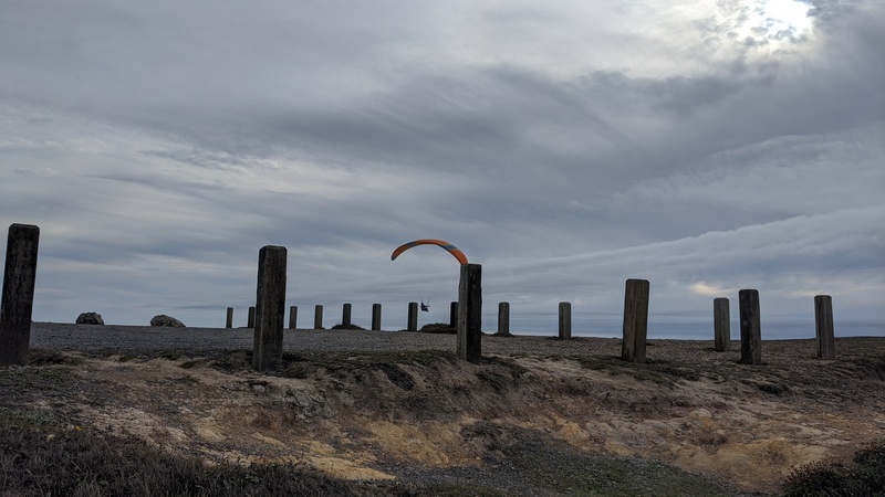
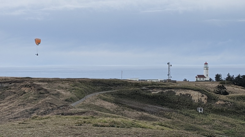
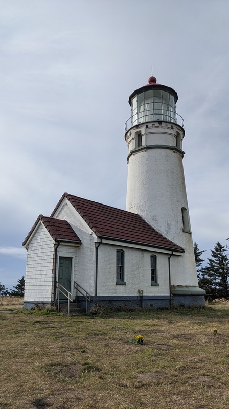

The lighthouse you see in the pictures above is the Cape Blanco lighthouse. It is still maintained and operated as a state park by the state of Oregon! Sadly it was closed when I got there, but visitors could still walk around the grounds of the park. I even saw a porcupine!
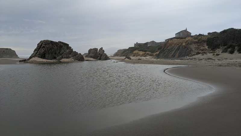
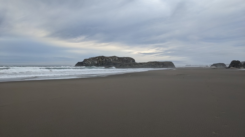
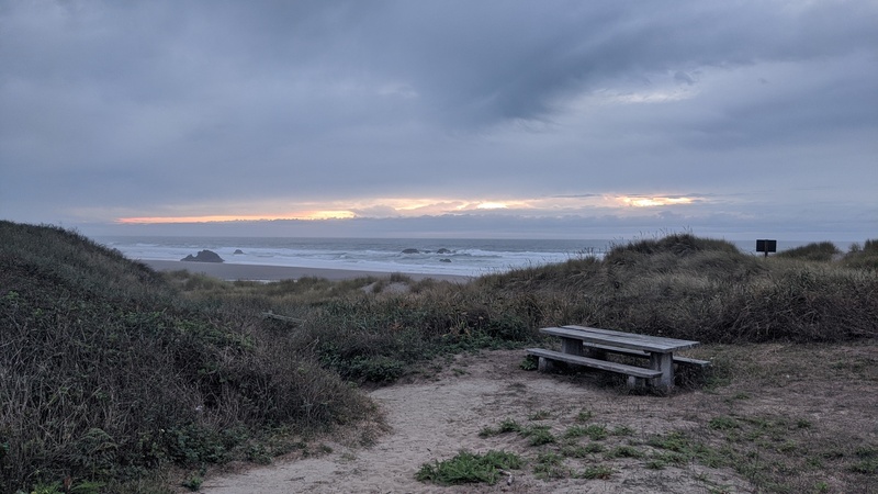
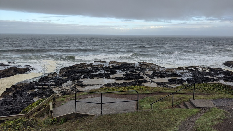
I attempted to watch the sunset on the beach at Devils Kitchen (above), but it ended up being super cloudy. It was still nice to sit on the beach, though and eat some food while it got darker.
Eventually after the sun set, I found a spot to camp near a trailhead and drifted away into sleep. It rained pretty hard that night! A storm came through but I stayed dry in my rental car.
Day 5: Siuslaw NF -> Tillamook, OR -> Darrington, WA

This was my last day of driving and I was able to see a lot!
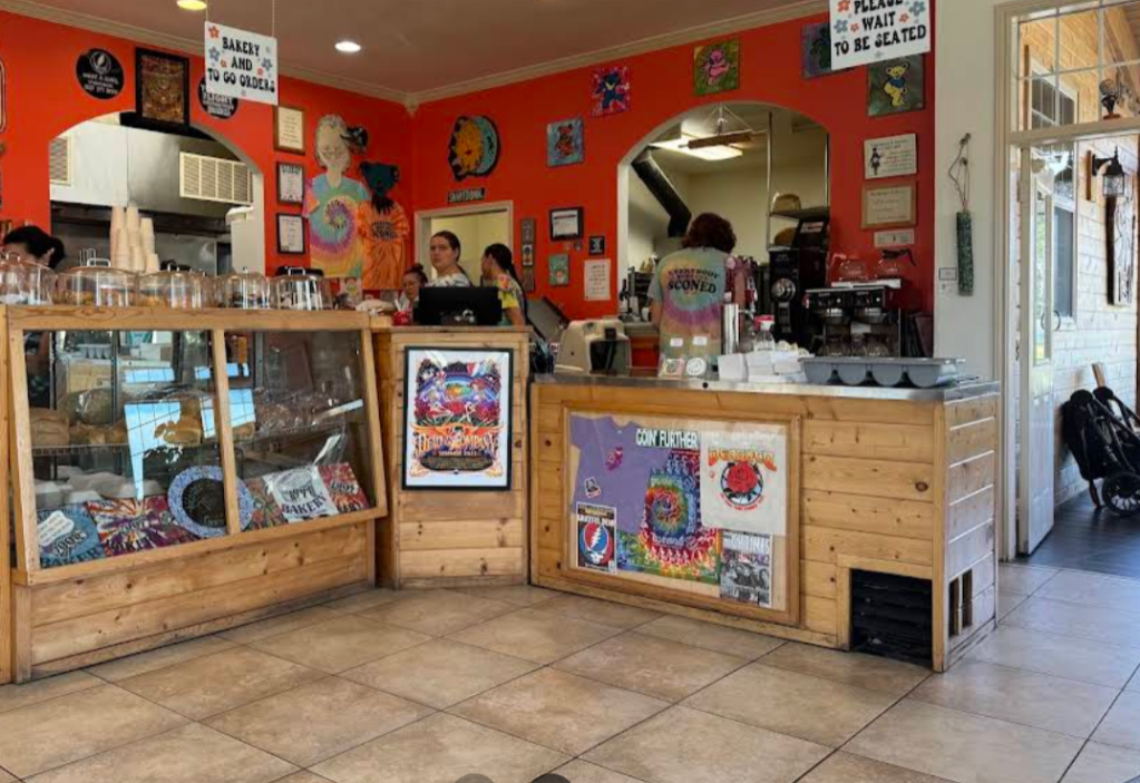
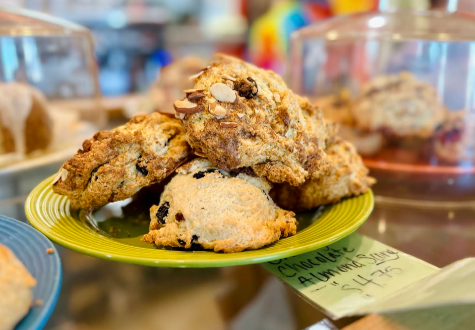
I started off by driving to the Grateful Bread bakery in Pacific City to get some breakfast. I don’t have any pictures, but here are some photos from google maps. I got a scone and it was pretty good!
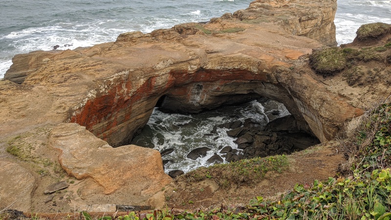
Along the coast, I stopped to check out two super popular stops: Thor’s Well and the Devil’s Punch bowl. I came at just the right tide to see both of these features at their best!
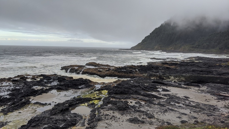
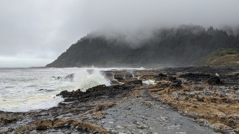
I got a video of Thor’s Well at low tide, which you can watch here:
Above is a video about some of the other features in the area at high tide. You can also learn more about Devil’s Punchbowl here
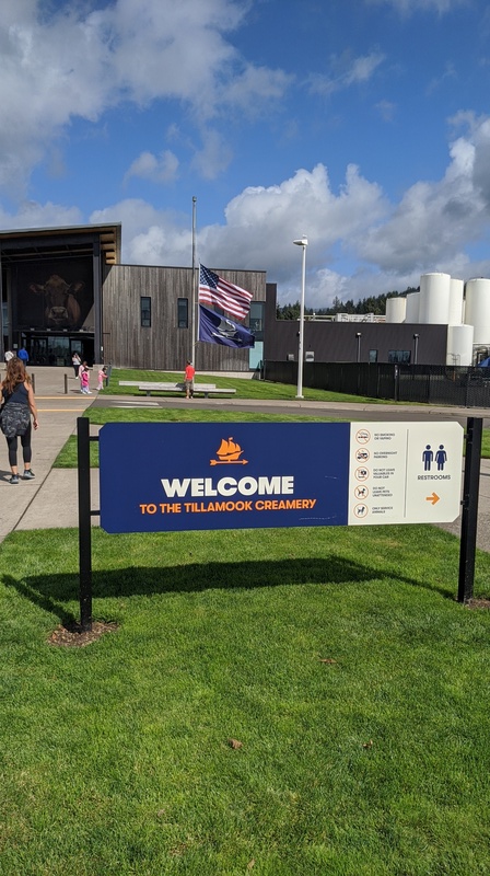
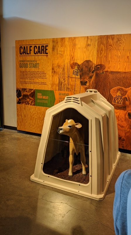
After those scenic coast sites, US-101 keeps going north into the town of Tillamook, OR – famous for the dairy company of the same name.
You can actually stop at the Tillamook factory to get a self-guided tour so that’s exactly what I did! They even had free samples of cheese.
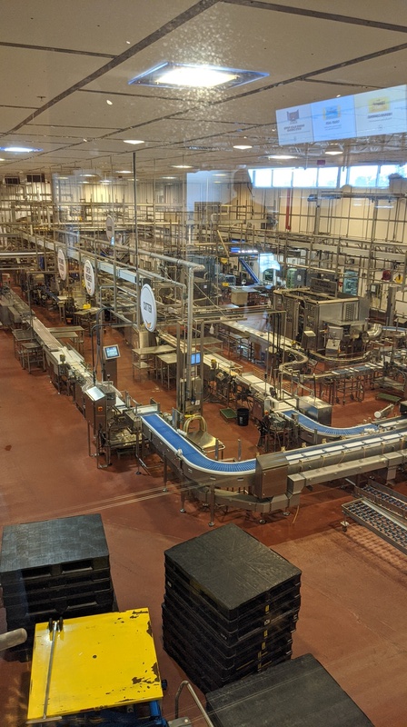
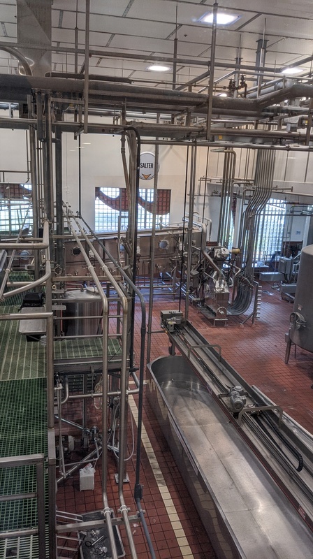
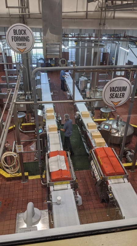
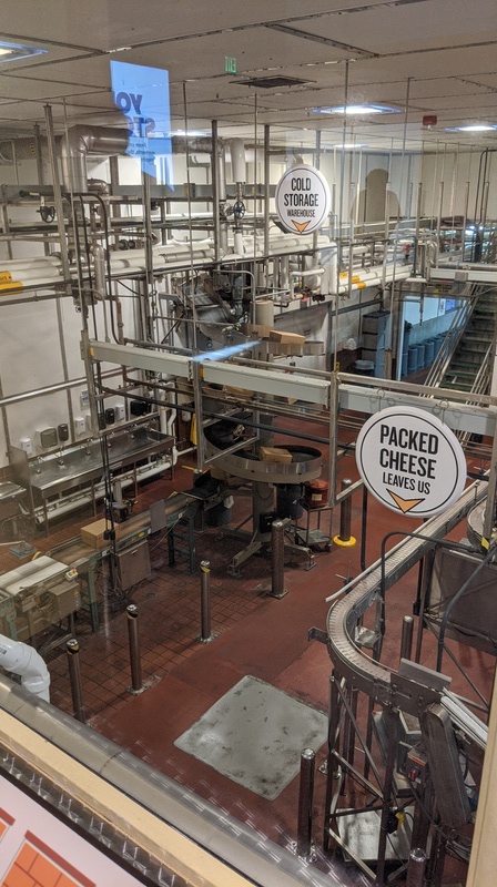
It was a slow day for them production-wise (I was there on a Sunday) so not much was going on on the factory floor. Here’s a more in-depth video of the tour if you want to learn more!
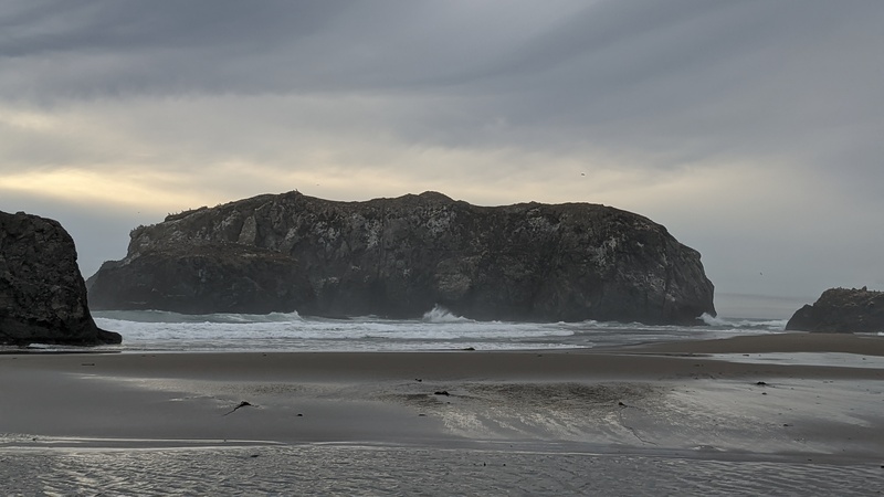
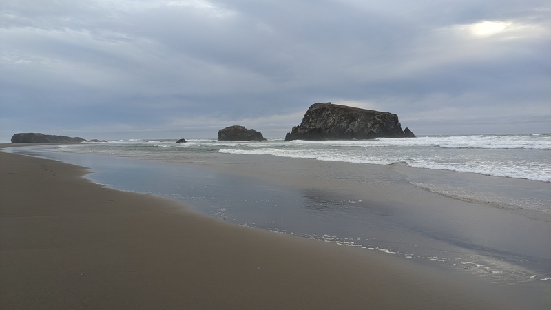
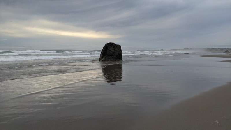
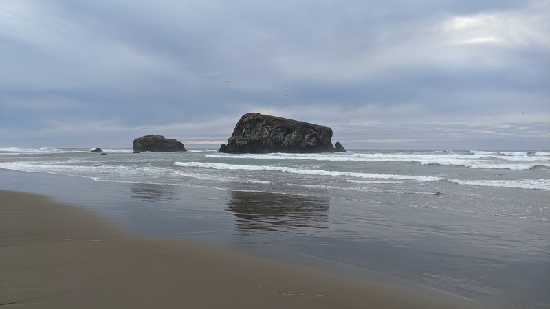
After the cheese factory, I got back on US-101 North to my next stop: Cannon Beach. The beach has a prominent rock called the Haystack, and it is really popular!
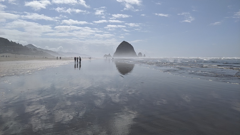
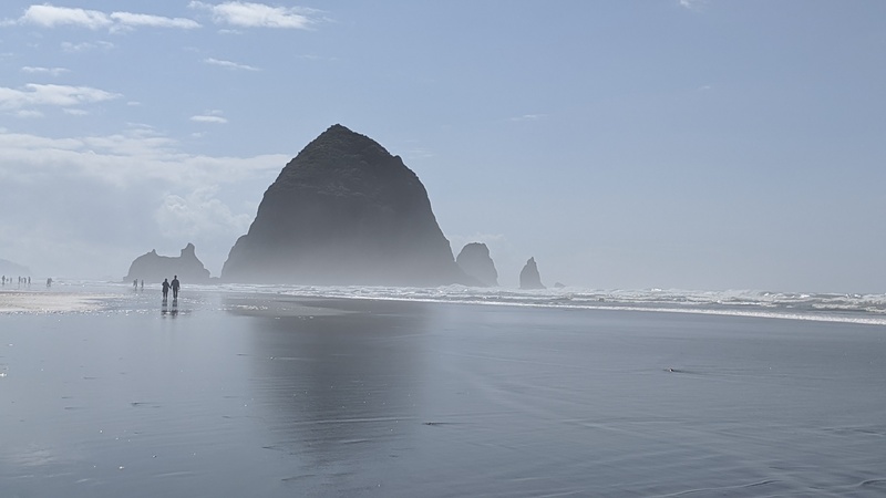
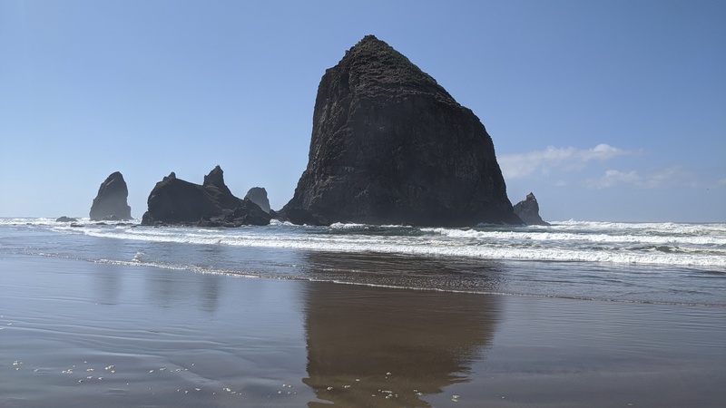
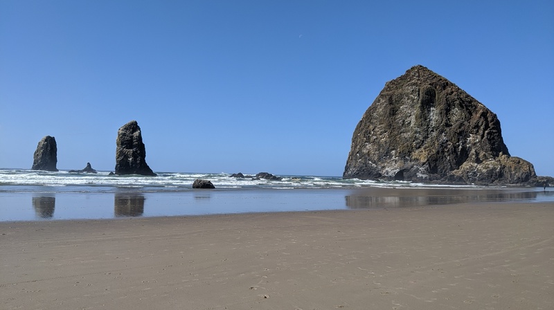
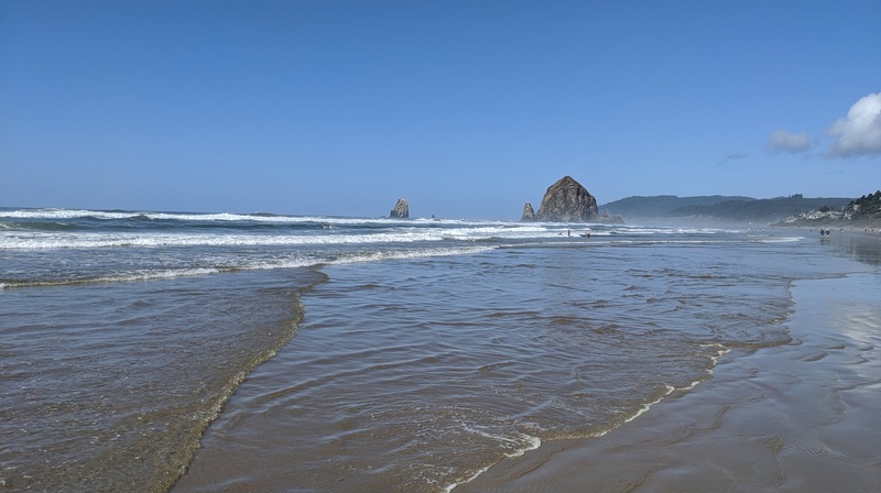
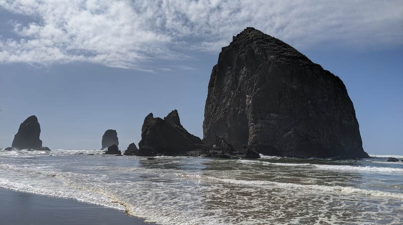
I spent a few hours here just walking around in the sand. In the summer I could imagine this place with beach-goers and maybe even swimmers – although the water is a bit rough in certain places.
My final stop in Oregon was Fort Clatsop National Historic Park, which ties back with my visit earlier this year to Pompey’s Pillar in Montana.
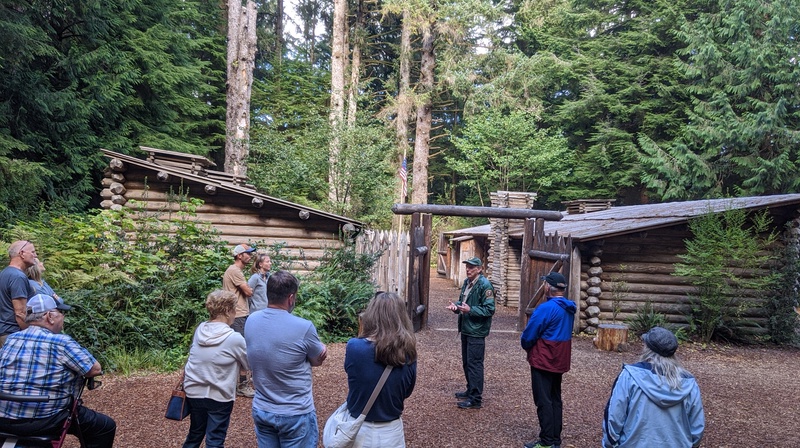
This fort was the end of the line for the Lewis and Clark expedition, and it’s where they overwintered in Oregon from 1805-1806. The park is a pretty cool place and the fort you see in the background is a replica from 2006. Another cool fact is that the Lewis and Clark expedition actually sent some of its members to Cannon Beach in order to acquire salt from the ocean.
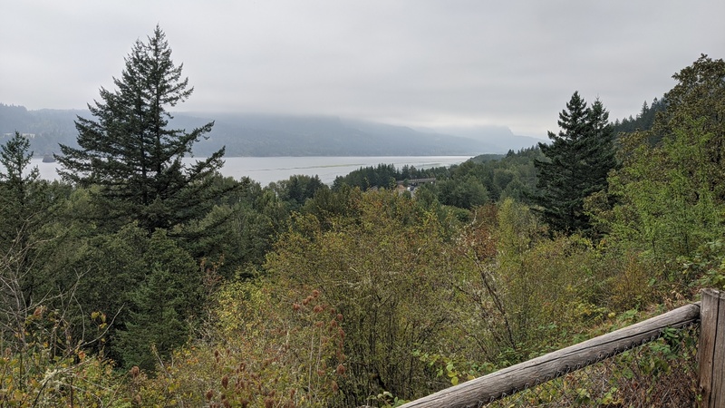
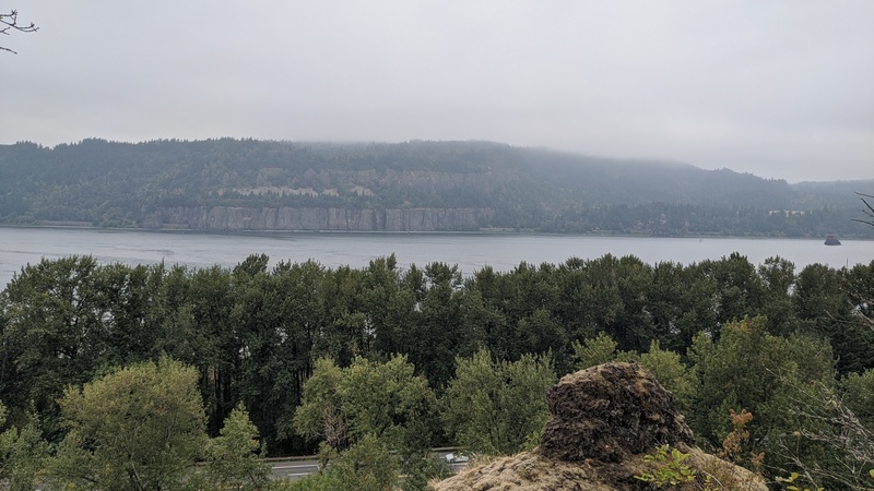
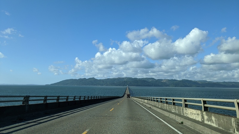
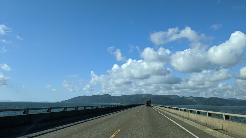
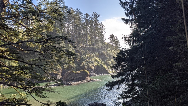
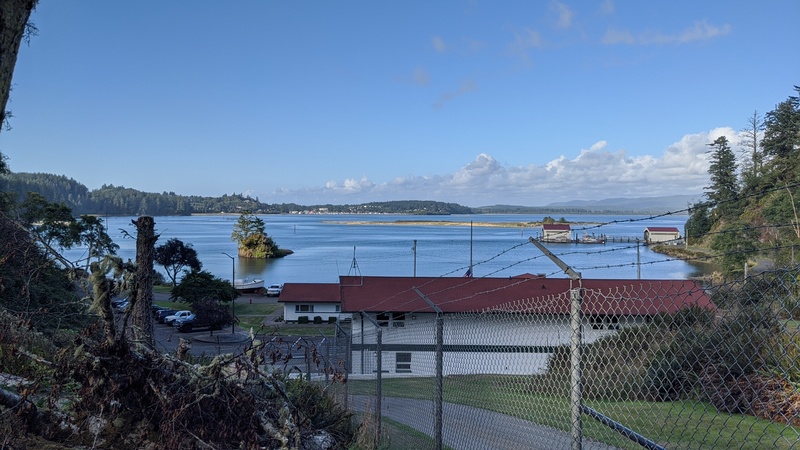
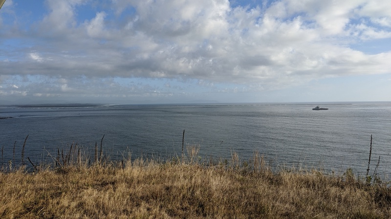
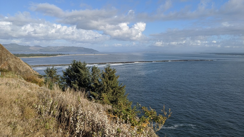
From Fort Clatsop, I said my goodbyes to Oregon and crossed the Astoria bridge, which is the second-longest truss bridge in the world. It had some really scenic views of the Columbia River!
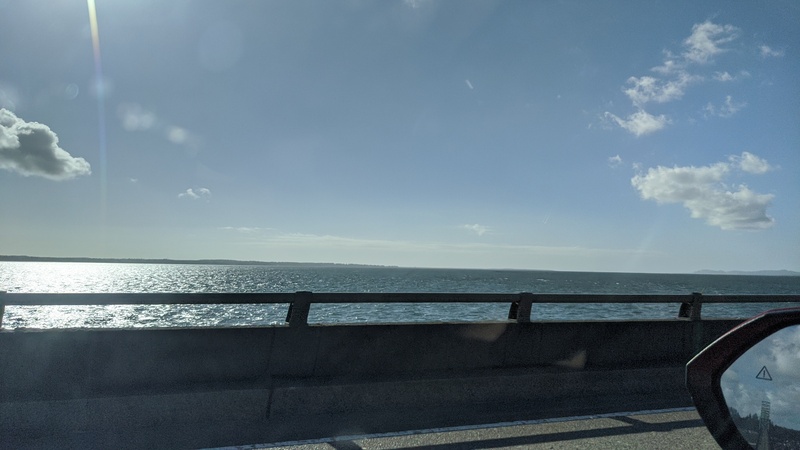
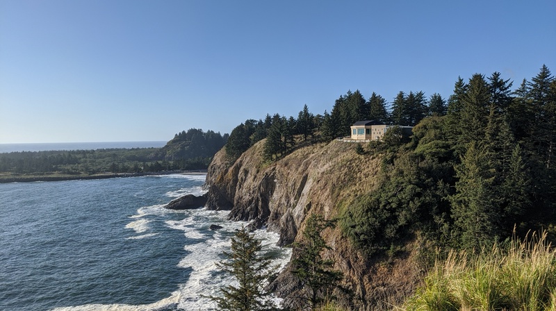
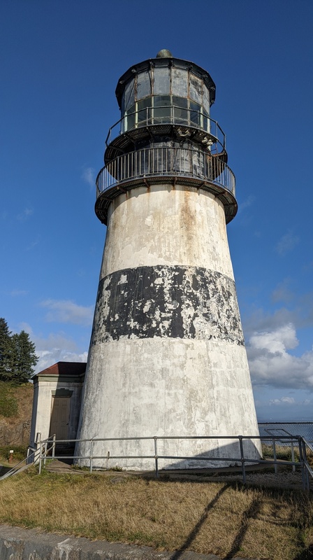
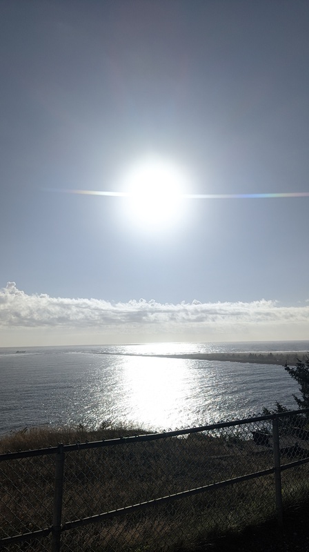
At this point, I was back in Washington, but I had one last stop to go to before my trip was over: Cape Disappointment. There’s a lighthouse there that you can visit, so I did, and I saw a beautiful golden-hour scene of the pacific ocean and Columbia River. A fitting way to end the trip.

So that was my Oregon Coast/Crater Lake/Redwoods trip! I kinda did a lot in 4 days. If I were to go back to these places again, I’d try to spend more time in each of them. I felt like I breezed through the Oregon Coast section since I was on a time crunch to get back to Darrington for work on Monday. There are lots of cool little towns and restaurants that you can stop in to spend your time (and money).
That’s all I have for you, dear reader. Until next time!

Leave a reply to johnna w. Cancel reply